
Jim McMahon/Mapman®
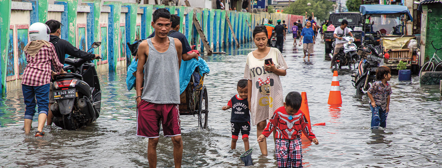
When floodwaters surge through Jakarta, Indonesia, people are often left with several feet of water in their homes. Like many residents, Saifullah sends his family to higher ground. Then he sets to work draining his house using a bucket.
“It’s a normal thing here,” Saifullah, who goes by one name, told reporters. “But this is our home.”
Saifullah is one of about 10.5 million residents of Jakarta, Indonesia’s bustling capital. The megacity on the island of Java is home to some of Indonesia’s largest businesses and has about as many skyscrapers as Chicago, Illinois.
Flooding has long been an issue in Jakarta. Thirteen rivers run through the Southeast Asian city, and they often overflow, particularly during Indonesia’s rainy season. Rising sea levels caused by climate change also pose a threat.
But the city has an even more pressing problem: It is sinking.
When floodwaters surge through Jakarta, Indonesia, people are often left with several feet of water in their homes. Like many residents, Saifullah sends his family to higher ground. Then he sets to work draining his house using a bucket.
“It’s a normal thing here,” Saifullah told reporters. He goes by one name. “But this is our home.”
Saifullah is one of about 10.5 million residents of Jakarta, Indonesia’s bustling capital. The megacity is on the island of Java. It is home to some of Indonesia’s largest businesses. It has about as many skyscrapers as Chicago, Illinois.
Flooding has long been an issue in Jakarta. Thirteen rivers run through the Southeast Asian city. They often overflow, especially during Indonesia’s rainy season. Rising sea levels caused by climate change also pose a threat.
But the city has an even more pressing problem: It is sinking.