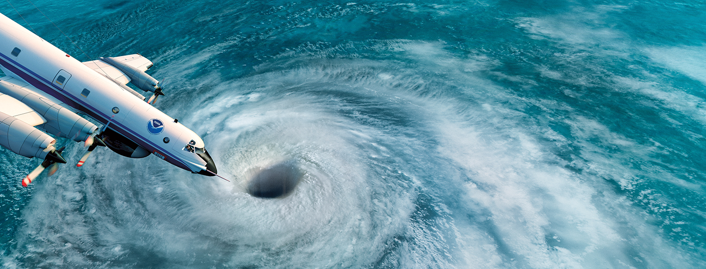
illustration of large research plane flying over eye of a hurricane

Illustration by MagicTorch

STANDARDS

Common Core: RH.6-8.1, RH.6-8.2, RH.6-8.4, RH.6-8.7, WHST.6-8.4, RI.6-8.1, RI.6-8.2, RI.6-8.4, RI.6-8.7, W.6-8.4, SL.6-8.1

NCSS: People, Places, and Environments • Individuals, Groups, and Institutions • Science, Technology, and Society

GEO QUEST

Latitude & Longitude

Into the Storm

When severe tropical storms strike, teams of hurricane hunters spring into action to predict their paths. During this year’s Atlantic hurricane season, they are testing advanced drone technology that could save many lives.

The 2020 Atlantic hurricane season was the busiest on record. Thirty tropical storms developed—and 14 of them turned into hurricanes, with winds at or exceeding 74 miles per hour. 

The Atlantic hurricane season runs from June through November, with storms developing in the Atlantic Ocean, the Gulf of Mexico, and the Caribbean Sea. This year’s Atlantic season is again predicted to be busier than usual.

Hurricanes are powerful spinning storms, frequently hundreds of miles wide. Because they can cause massive destruction, it’s crucial that scientists learn as much as they can about them before the storms approach land and endanger lives. 

That’s where hurricane hunters come in. These brave National Oceanic and Atmospheric Administration (NOAA) scientists fly into storms to gather data that can help predict a weather system’s path and intensity. Officials use that information to decide whether to order people to evacuate an area.

And now, hurricane hunters are testing a new tool that may significantly improve hurricane forecasts: drones. Released from the planes midflight, the unmanned aircraft can reach parts of major storms that humans are unable to access.
Nick Underwood, NOAA

NOAA hurricane hunters fly into major storms to gather data. 

Sizing Up a Storm

Piloting a plane in a hurricane isn’t easy. Violent winds can make for a very bumpy ride, and missions can last hours. 

All the while, the hurricane hunters on board collect data to inform storm forecasts. They use tools including radar and dropsondes (DROP-sahnds), devices that are released midflight. Attached to a parachute, a dropsonde measures air pressure, humidity, temperature, and wind direction and speed—but only briefly as it falls to the sea. 

All of the data that hurricane hunters collect is sent to other scientists on the ground, who then feed it into computer models that simulate a storm’s development. That allows forecasters to make predictions about when and where a storm will make landfall and how powerful it will be. 

Illustration by MagicTorch; Area-I/NOAA

This drone is being tested by NOAA for deployment from aircraft into storms.

Dropping in Drones

By also releasing drones, hurricane hunters should be able to collect additional data to create a much more complete picture of storms. Unlike dropsondes, which capture only a few moments’ worth of storm data, drones can fly inside a hurricane for hours. 

“Drones can help us go from a snapshot of a hurricane to a movie,” says Joseph Cione, lead meteorologist at NOAA’s Atlantic Oceanographic and Meteorological Laboratory Hurricane Research Division. 

In particular, experts expect drones to provide more information about a storm’s boundary layer—where the ocean’s surface meets the atmosphere. There, violent winds and huge waves make it too dangerous for piloted aircraft. Learning more about this area will help scientists understand not only more about a hurricane’s structure and intensity, but also what’s happening in the part of the storm people may face.  

Humans also live at the boundary layer, Cione says. So it’s key for scientists to know “what’s going on down low—especially as storms prepare to make landfall,” he explains.

Final Tests

NOAA hopes to test up to three drones in storms that form during this year’s Atlantic hurricane season. If all goes well, the drones will be used routinely in the future. 

Says Cione, “We can learn a lot more about what the storm looks like, so we can help get people out of harm’s way.” 

Check out Map Skills Boot Camp for more geography practice.

videos (1)
Skills Sheets (3)
Skills Sheets (3)
Skills Sheets (3)
Lesson Plan (2)
Lesson Plan (2)
Text-to-Speech