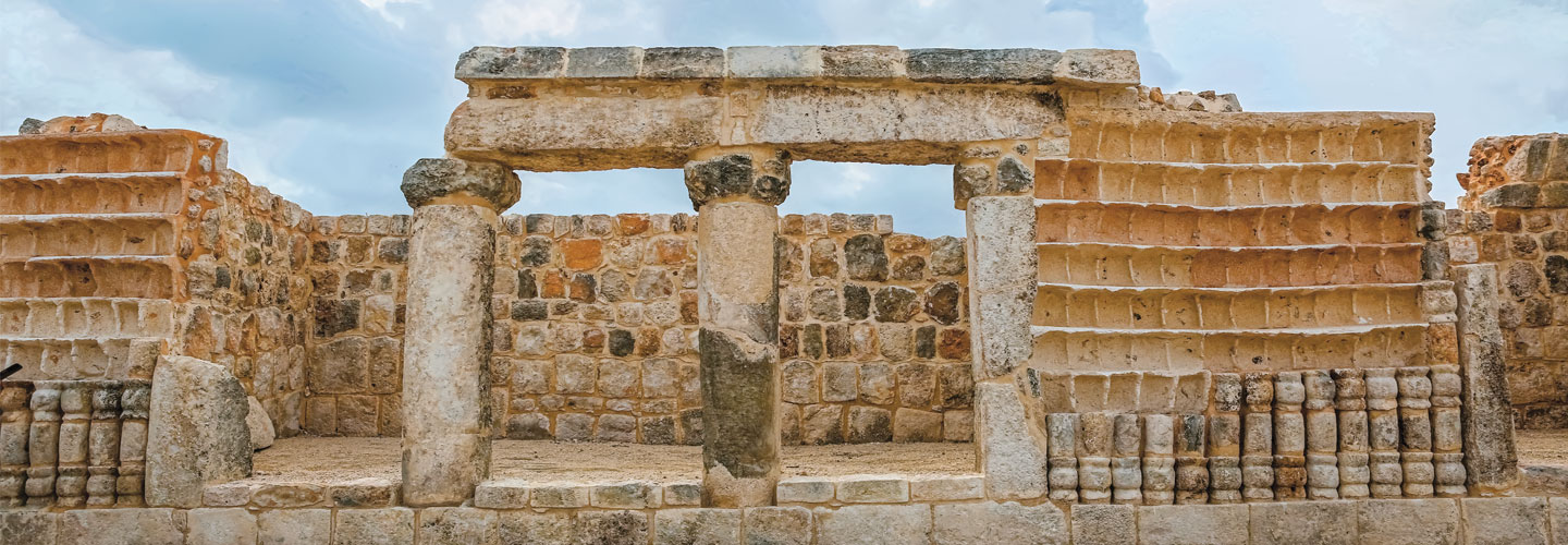
In 2015, a construction crew was digging near Mérida, a city on Mexico’s Yucatán
The local
STANDARDS
Common Core: RH.6-8.1, RH.6-8.2, RH.6-8.4, RH.6-8.7, WHST.6-8.4, RI.6-8.1, RI.6-8.2, RI.6-8.4, RI.6-8.7, W.6-8.4, SL.6-8.1
NCSS: Culture • Time, Continuity, and Change • People, Places, and Environments • Science, Technology, and Society • Global Connections
GEOGRAPHY
Lost City of the Maya
New clues from a Maya settlement in Mexico reveal how members of the ancient civilization lived, worked, and mapped out their cities.
In 2015, a construction crew was digging near Mérida, a city on Mexico’s Yucatán
The local
The Maya were an ancient
The newly discovered ruins—called Xiol (zuh-EYE-ul)—are spread across more than 50
Experts say as many as 4,000 Maya may have lived in Xiol, including
“There were people . . . who lived in these great palaces, and there were also the common people who lived in small buildings,” archaeologist Carlos Peraza Lope told reporters.
Ahead of Their Time
Among their accomplishments, the Maya created an advanced form of writing. They also invented a system of numbers that was one of the first to use symbols to represent zero.
What’s more, the Maya tracked planets, the moon, and the sun before telescopes were invented. They used this information to create a calendar based on Earth’s orbit around the sun, long before Europeans did.
The Maya were also skilled farmers. They grew everything from corn to avocados, despite living on hilly, swampy land.
Mapping Maya Cities
As their empire grew, the Maya founded several cities, including Chichén Itzá in Mexico and Tikal in Guatemala. They paid close attention to compass directions when planning their communities (see "Understanding Directions and Distance," below). A number of Maya pyramids and ceremonial buildings face certain directions to align with the sun and stars. Some Maya kings even built their palaces to the north of other buildings because they believed that direction represented power.
To connect their growing cities, the Maya designed networks of roadways, which they traveled by foot. Experts have even found a system of Maya “highways” in Guatemala that stretched more than 150 miles!
But by the mid-1500s, the Spanish had conquered most of the empire in search of gold. The last Maya city fell in 1697.
The Maya Legacy
Today, more than 7 million Maya descendants live in Mexico and Central America. Their ancestors continue to fascinate people, and the city of Xiol is the latest reason why.
Many of Xiol’s buildings feature an
As with every Maya mystery that remains today, scientists hope that—with time—they’ll learn why.
SKILL SPOTLIGHT: Using Direction and Distance
Use the map of the Maya Empire (above) and the information you have learned about direction and distance to answer the questions.
1. What do we use to find direction on a map?
2. What are the cardinal directions?
3. What are the intermediate directions?
4. Which labeled national capital is southwest of the Maya ruins of Tikal?
5. What is used to measure distance on a map?
6. About how many miles separate the Maya ruins of Xiol and Chichén Itzá?
7. In kilometers, about how far apart are the capitals of Guatemala and El Salvador?
8. Which Maya ruins are about 185 miles northwest of the capital of Honduras?
9. In which intermediate direction would you travel to get from Tikal to Copán?
10. Which labeled city is about 160 kilometers southwest of Xiol?