A photograph of the border fence at Sasabe, Arizona

Ekansh Tambe

STANDARDS

Common Core: RH.6-8.1, RH.6-8.2, RH.6-8.7, WHST.6-8.4, RI.6-8.1, RI.6-8.2, RI.6-8.7, W.6-8.4, SL.6-8.1

NCSS: People, Places, and Environments • Individual Development and Identity • Global Connections

GEO QUEST

Direction & Distance

Border in Focus

A Texas teen documented the U.S.-Mexico border to learn more about the controversial divide

Courtesy of Ekansh Tambe

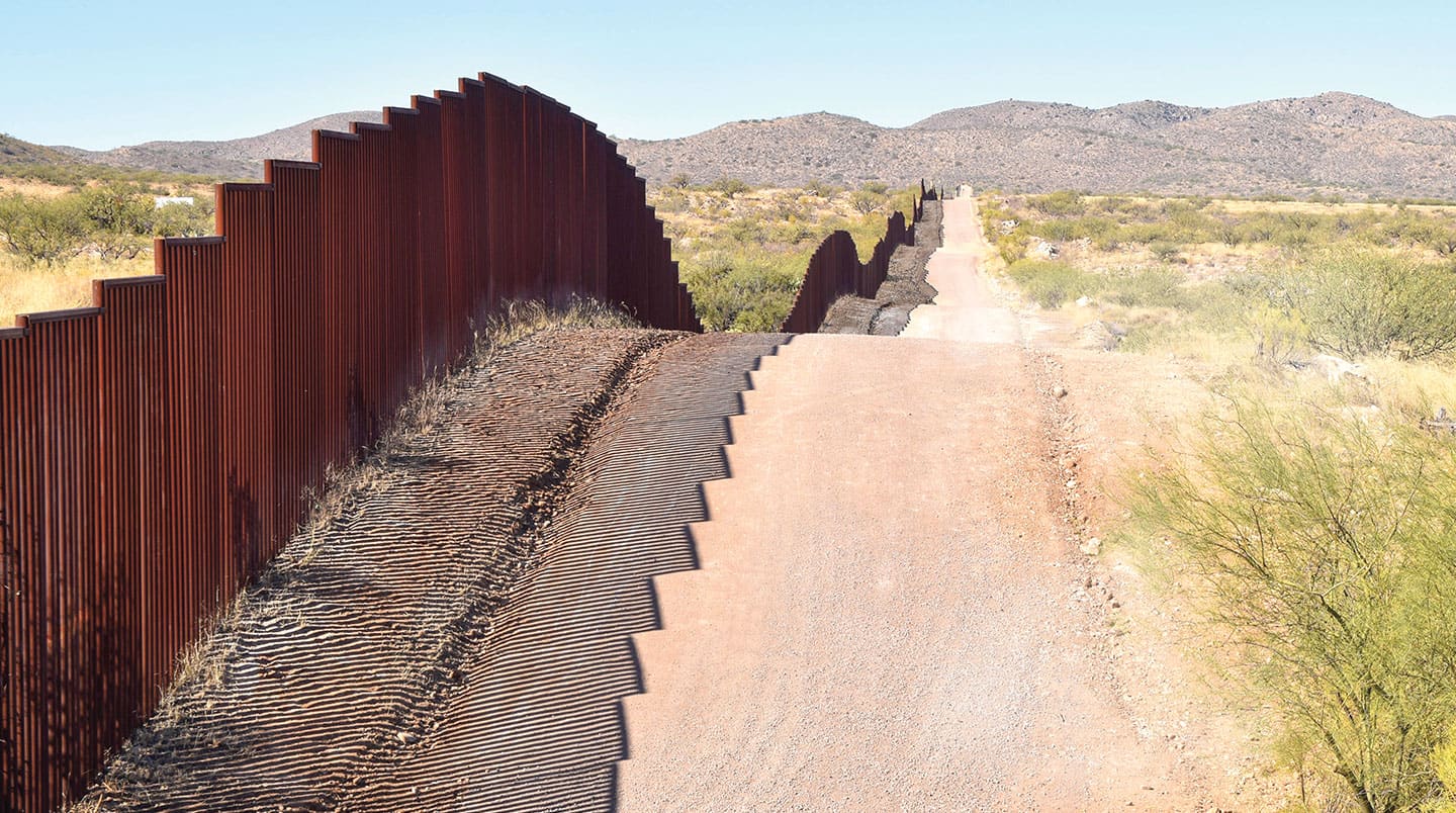
Ekansh Tambe heard stories about the U.S.-Mexico border long before he ever saw it: News reports about people crossing it illegally to escape poverty and violence in their homelands. Warnings about criminals smuggling drugs across it. And heated debates over whether a wall should be built along its entire length.

“I had questions like ‘What does the border really look like?’ and ‘What drives immigrants to undertake the dangerous journey north?’ ” recalls Ekansh, now 16. The then-middle schooler decided to visit the border to find out. 

In 2017, he and his family drove from their home in Dallas, Texas, to Brownsville, Texas, the easternmost U.S. city along the border. From there, they explored nearly 400 miles of the dividing line. 

Along the way, Ekansh interviewed people and took thousands of photos. But he still wanted to learn more.

Soon after, Ekansh convinced his parents to let him explore the rest of the 1,900-mile span—along the Rio Grande, across mountains, and through cities, deserts, sand dunes, and even cactus fields. “It was essential to understand every perspective at the border by talking to the border patrol agents, immigrants, and citizens,” he says. 


Ekansh Tambe

Ekansh photographs a stretch of the border fence in 2017.

Dividing Lines

For many years, the divide between the U.S. and Mexico went unmarked, with people and animals passing freely over it. The first fences went up in the early 20th century, when the U.S. government put up barbed wire to prevent cattle from wandering out of the country.

Today, the border features about 700 miles of human-made barriers—a patchwork of concrete slab walls, chain-link fences, and steel slats. Almost all of those dividers were built in the past two decades, in response to concerns about people crossing into the U.S. without permission. Last year, President Donald Trump directed federal funding toward building more barriers.

Ekansh visited both sides of the border during his travels. The people he met were eager to share their stories, he says. 

Near Antelope Wells, New Mexico, he talked with a border agent whose patrol area was so isolated that he rarely saw people. In a town in Texas, a woman gave Ekansh an impromptu four-hour tour. “She shared her story of how she crossed the border illegally at the time and struggled to make ends meet,” he says. “She won my heart.”


Ekansh Tambe

While in Tijuana, Mexico, Ekansh snapped these border wall samples that were leaning against the U.S. side of the fence.

Going Global

Ekansh published a book of his photographs, The Great Divide: A Journey Across the US-Mexican Border. He also exhibited his pictures at the National Border Patrol Museum in El Paso, Texas.

He has since gone on to document other controversial borders around the world, including the heavily armed boundary between North Korea and South Korea. 

The teen has given public speeches about his border experiences. He enjoys sharing the insights he has gained. After all, Ekansh says, every single journey teaches him something new. “Borders are so much more than just areas of political conflict and hardship,” he explains. “They are also places of trade, commerce, beautiful landscapes, culture, language, and exchange of ideas.”


Border Line 

This map shows existing barriers, and those under construction, along the U.S.-Mexico border. Read about direction and distance below. Then use what you have learned to answer the questions that follow.

Jim McMahon/Mapman®

DIRECTION Find the compass rose on the map. It shows the cardinal directions: north, east, south, and west. Halfway between any two of them is an intermediate direction: northeast, southeast, southwest, or northwest.

DISTANCE A map has its own scale of miles or kilometers that compares distance on the map with the actual distance on Earth’s surface. You can measure distance by placing the edge of a piece of paper along two points on a map. Mark the center of each point on the paper. Then compare those marks with the map’s scale of miles.


MAP SKILLS

1. Which labeled body of water is east of Brownsville, Texas?

2. What is the westernmost Mexican city along the border?

3. In which intermediate direction would you travel to get from that city to Nogales, Arizona?

4. Which U.S. states share a border with Mexico? 

5. Which of those states is the farthest east? 

6. About how many miles separate the capital of Mexico and Matamoros, Mexico?

7. Which labeled U.S. city is about 100 miles from Nuevo Laredo, Mexico?

8. About how far is Ciudad Juárez, Mexico, from Lubbock, Texas?

9. What is the straight-line distance between Columbus, New Mexico, and Cabo San Lucas, Mexico?

10. Which labeled city is about 250 miles northwest of Mexico City? 

Check out Map Skills Boot Camp for more geography practice.

videos (1)
Skills Sheets (2)
Skills Sheets (2)
Lesson Plan (3)
Lesson Plan (3)
Lesson Plan (3)
Text-to-Speech