Egypt relies on the Nile as its main source of water. Residents worry that the dam could drastically reduce the river’s water levels.

Shutterstock.com

STANDARDS

Common Core: RH.6-8.1, RH.6-8.2, RH.6-8.4, RH.6-8.7, WHST.6-8.4, RI.6-8.1, RI.6-8.2, RI.6-8.4, RI.6-8.7, W.6-8.4, SL.6-8.1

NCSS: People, Places, and Environments • Science, Technology, and Society • Global Connections

GEO QUEST

Latitude & Longitude

The Fight Over the Nile

How the construction of a dam in northeast Africa has led to a heated dispute over the continent’s famed Nile River

Jim McMahon/Mapman®

Construction of a massive dam in Africa is nearly complete, but the $4.5 billion project is flooded in controversy.

The Grand Ethiopian Renaissance Dam (GERD) is being built in Ethiopia on the Blue Nile. (A dam is a human-made structure designed to collect water from a river. Water builds up behind it in an artificial lake called a reservoir, to be used for everything from irrigation to generating electricity.)

When the GERD is finished in 2023, it will be able to hold nearly 20 trillion gallons of water in a reservoir the size of London, England. Officials say it will help provide electricity for about 75 million people in Ethiopia—many of whom currently lack it—plus millions more in neighboring countries. 

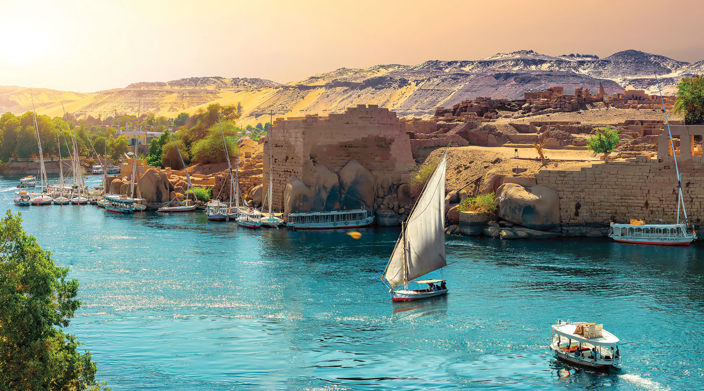
But not everyone is happy about the project. The Blue Nile is a tributary of the Nile, the world-famous river that winds its way through Egypt and gave rise to one of history’s greatest civilizations.

Today, nearly all of Egypt’s 100 million people live along the Nile and depend on it as their main source of water. Many of the nation’s residents are concerned that the GERD could drastically reduce their water supply, destroying countless crops and thousands of farmers’ jobs. The issue has led to a bitter clash between the two countries. 

Construction of a massive dam in Africa is nearly complete. But the $4.5 billion project is flooded in controversy.

The Grand Ethiopian Renaissance Dam (GERD) is being built in Ethiopia on the Blue Nile. (A dam is a human-made structure designed to collect water from a river. Water builds up behind it in an artificial lake called a reservoir. The water can be used for everything from irrigation to generating electricity.)

The GERD will be finished in 2023. It will be able to hold nearly 20 trillion gallons of water in a reservoir the size of London, England. Officials say it will help provide electricity for about 75 million people in Ethiopia. Many of them currently lack it. It will also help provide electricity for millions of people in neighboring countries.

But not everyone is happy about the project. The Blue Nile is a tributary of the Nile. The Nile is the world-famous river that winds its way through Egypt and gave rise to one of history’s greatest civilizations.

Today, nearly all of Egypt’s 100 million people live along the Nile. They depend on it as their main source of water. Many of the nation’s residents are concerned that the GERD could drastically reduce their water supply. That could destroy countless crops and thousands of farmers’ jobs. The issue has led to a bitter clash between the two countries.

Water War

The main disagreement between Ethiopia and Egypt is how quickly the dam should be filled. Ethiopia wants to fill the GERD as fast as possible—in no more than seven years. (As this issue went to press, the country was preparing to start partially filling the dam in order to test it.) But Egypt is pushing for a longer timetable to minimize the impact on the Nile. 

With tensions mounting, both countries have threatened military action. Earlier this year, the United Nations stepped in to try to help resolve the dispute.

The main disagreement between Ethiopia and Egypt is how quickly the dam should be filled. Ethiopia wants to fill the GERD as fast as possible, in no more than seven years. (As this issue went to press, Ethiopia was preparing to start partially filling the dam in order to test it.) But Egypt is pushing for a longer timetable to minimize the impact on the Nile.

With tensions mounting, both countries have threatened military action. Earlier this year, the United Nations stepped in to try to help settle the dispute.

Laura Boushnak/The New York Times/Redux 

Ethiopia is building a huge dam on a river that feeds into the Nile.

A River at Risk

Meanwhile, experts who study the Nile agree that the river is under threat, but they say that has little to do with the dam. Surging population rates—along with more frequent hot and dry periods caused, in part, by climate change—are reducing water levels in the Nile. That could lead to water shortages for 250 million people in northeast Africa by the end of the century. 

Regardless of when the dam is filled, scientist Ethan Coffel recently told The New York Times, “life is going to get much harder . . . on the Nile.”

Meanwhile, experts who study the Nile agree that the river is under threat. But they say that has little to do with the dam. Surging population rates are reducing water levels in the Nile. Water levels are also being reduced by more frequent hot and dry periods caused, in part, by climate change. That could lead to water shortages for 250 million people in northeast Africa by the end of the century.

Regardless of when the dam is filled, scientist Ethan Coffel recently told The New York Times, “life is going to get much harder . . . on the Nile.”

Navigating the Nile 

Like all places, Ethiopia’s new dam on the Blue Nile has a precise location: the point at which lines of latitude and longitude cross. Read about how to use latitude and longitude below to pinpoint any place on Earth. Then answer the map questions below.

Like all places, Ethiopia’s new dam on the Blue Nile has a precise location: the point at which lines of latitude and longitude cross. Read about how to use latitude and longitude below to pinpoint any place on Earth. Then answer the map questions below.

Jim McMahon/Mapman®

Jim McMahon/MapMan®

LATITUDE is measured in degrees (°) north (N) and south (S) of the equator, an imaginary line that circles the globe at 0°. Lines of latitude increase up to 90°N (at the North Pole) or 90°S (at the South Pole).

LATITUDE is measured in degrees (°) north (N) and south (S) of the equator, an imaginary line that circles the globe at 0°. Lines of latitude increase up to 90°N (at the North Pole) or 90°S (at the South Pole).

Jim McMahon/MapMan®

LONGITUDE is measured in degrees (°) east (E) and west (W) of the prime meridian, an imaginary line at 0° that passes through London, England. Longitude increases up to 180° as you move east or west.

LONGITUDE is measured in degrees (°) east (E) and west (W) of the prime meridian, an imaginary line at 0° that passes through London, England. Longitude increases up to 180° as you move east or west.

MAP SKILLS

1. Latitude measures distance north and south of what imaginary line? 

2. What lines on a map are used to measure distance in degrees east and west of the prime meridian? 

3. What is the capital of Ethiopia?

4. The Tropic of Cancer (a named line of latitude) passes through which countries labeled on the map?

5. Which cities labeled on the map are south of 20°N?

6. Which line of latitude passes through the capital of Egypt?

7. In which country do the Blue Nile and the White Nile tributaries meet to form the Nile?

8. What is the approximate latitude and longitude of that country’s capital?

9. Which city is located at 24°N, 33°E?

10. What is the approximate latitude and longitude of the Grand Ethiopian Renaissance Dam?   

Check out Map Skills Boot Camp for more geography practice.

Interactive Quiz for this article

Click the Google Classroom button below to share the Know the News quiz with your class.

Download .PDF
Skills Sheets (5)
Skills Sheets (5)
Skills Sheets (5)
Skills Sheets (5)
Skills Sheets (5)
Lesson Plan (3)
Lesson Plan (3)
Lesson Plan (3)
Leveled Articles (1)
Text-to-Speech